
“Dog. Big dog. Little dog. Big dogs and little dogs. Black and white dogs.”
Wait, wait. This isn’t a re-enactment of “Go, Dog, Go!” by P.D. Eastman, but for anyone who has read that book a million times–and what parent or babysitter hasn’t?!–the story will enter your brain while you’re visiting the City of San Antonio’s Dog Park in McAllister Park.
I kept expecting to see a giant dog party atop one of the Live Oak trees there, and I must admit that I was disappointed when I didn’t. Plenty of cute dogs were having fun on the ground, but I didn’t spot any hats. The 1.5-acre dog park is open from 5 a.m. to 11 p.m. seven days a week, but bring a flashlight if you’re there before sunrise or after sunset. No lights in the dog park.

Before our walk, I knew that a local freeway, 281, was named for the former mayor of San Antonio, but I did not know that he was one of the founders of the Alamo Colleges. Thank you, Mayor McAllister!
Aside from the dog park, McAllister Park is another good place to begin exploring the Salado Creek Greenway. It’s 2.4 miles from McAllister Park to Lady Bird Johnson Park, or almost a 5-mile round trip.

My husband and I walked it, and I think I’d rather bike it the next time. It’s a bit far for an afternoon (or morning) walk. The Oakwell Trailhead to the Tobin Trailhead or the Lady Bird Johnson Trailhead to the Tobin Trailhead are better for a reasonably long walk. Both are about 3 miles round trip.

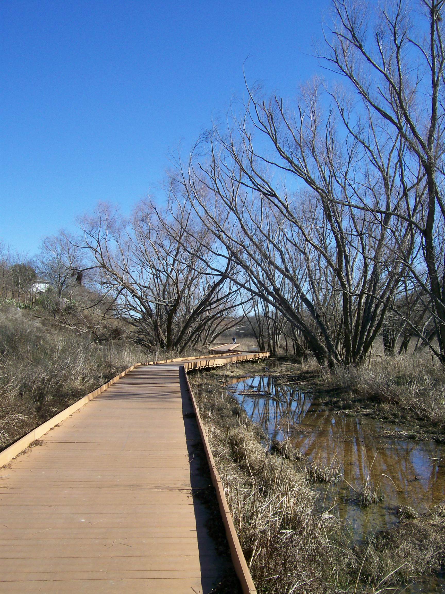
From McAllister, head south to the Lady Bird Johnson Park. You’ll be on airport property for part of the trail, so you’ll be able to watch planes landing and taking off. You’ll cross under Wetmore Road and some train tracks and continue along a paved asphalt trail until you come to the 3,400-foot Morningstar Boardwalk, named for a local soldier who was killed in the Iraq War. We ran into some friends on the boardwalk, and they said that they had walked it the weekend before after it had rained a lot, and it was like walking on top of a lake. Use caution, though! If there’s been too much rain, the area is a flood zone and would be dangerous.


We saw a Red-Shouldered Hawk along the boardwalk, soaring overhead and calling out. Other wildlife we spotted included families on bikes and teenagers on scooters. It was good to see people outside, enjoying a pretty day and getting some exercise. If you haven’t been yet, what are you waiting on?!
Denise Barkis Richter, Ph.D., author of “San Antonio’s Passport to Fun,” has been blogging about San Antonio since June of 2010. Follow her at facebook.com/SanAntonioTourist so that you’ll never miss a post. Her love affair with the Alamo City began at Hemisfair in 1968. She moved to San Antonio in 1979 as an 18-year-old college student, and San Antonio has been her home ever since. Denise completed certification to become a professional tour guide in 2019. Please contact her at sanantoniotourist at gmail dot com if you’d like for her to curate a fabulous San Antonio experience for you!
Hi Denise! Love your site. Found several gems, I didn’t even know about, and I pride myself on being an epicure of the “off the beaten track.”
I read your great posts on the Salado Creek Greenway and thought you might get a kick out of a bike video I made last month. North San Antonio to Downtown. I don’t think people are aware that you can go the entire distance and most has a designated bike route.
Anyways…….. here it is.
http://gallery.me.com/paulbrainerd#101037
8 min 45 sec.
click double arrows lower right of video for full screen, and crank up the volume 🙂
Enjoy the ride! And thanks again. I’ll be sure to keep reading.
…..Paul
Paul, Thanks for reading/commenting! Thanks also for your bike video. That’s on my to-do list! I also want to head south to the missions. Viva San Antonio! Never a dull moment. Cheers, Denise
Hi Denise,
Thank you for your post! Very informative! I drive down Wetmore all the time and see runners and cyclists on the trail and have wondered how they access the trail.
I explored today, I turned into the entrance off of Starcrest near Wurzbach Parkway and there was only one sign that indicated McAllister Soccer Fields and Dog Park.
I couldn’t tell where to access the trail from there. Do you know if there is access there?
I would have gotten out but being a woman makes it difficult to explore alone.
Any information you could give me would be great. I plan on exploring with friends on Sunday but if you have some advice about that particular area that would be helpful.
Once again, thank you for your post!
Sincerely,
Gypsy
Gypsy, Thanks for reading my blog. I’m happy you find it informative! Grab a friend (two-legged or four-legged) and head out to the trails. You’ll really enjoy them! As for trail access, here’s a link with a map you may download: http://www.sanantonio.gov/parksandrec/greenway_trails_salado_greenwaynorth.aspx Hope this helps! Cheers, Denise